How to reach the tourist office?


From 01/06 to 15/10 daily.
Subject to favorable weather.
Distance : 3.3km
Duration : 1h30
Height difference : 135m
Max altitude : 1825m
Wooden posts and yellow signs, indicating the names of the localities and the remaining journey time.
Tracé GPX
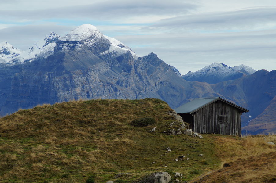
This aerial route is a wonderful viewpoint over the Chablais, Haut Giffre and Mont Blanc massifs. The Joux Plane lake is an artificial lake used to water the herds of the mountain pasture and to regulate the course of the Valentine torrent.
Difficulty: easy
Start: Joux Plane lake (located at the top of the Joux Plane pass)
Map reference: Vallée du Haut Giffre topo-guide
From the Joux Plane lake, take the path on the right which leads to the real Joux Plane pass located between the Tête de Vuargne* on the left (which we will climb) and the pointe d'Angolon on the right. From the pass, a path quickly rises up the grassy slope by a few tight switchbacks to reach a rocky projection.
The path skirts around it on the left, crosses the slopes overlooking the lake and then rises in a valley before reaching the ridge.
The path continues, without further difficulty, opening up a splendid view of the Mt Blanc range on the left and the Chablais mountains on the right.
A few hundred metres further on, the Ranfolly chairlift station appears (Les Gets ski area). In front of the station, an orientation table will allow you to put a name on the summits that surround you.
Continuing along the ridge, the path descends quietly to the Col road. Once you have reached the road, turn left to reach the lake.
Itinerary for guidance only.
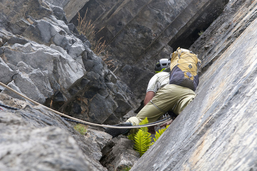
This site can be divided into 2 sectors: On your left, windmills often vertical, even overhanging, with many routes between 6b and 7b +, and some easier routes, some of which are slabs. On your right, the large 100 m slab.
This superb tour combines several hikes set out in the guide published by the Upper Giffre association.
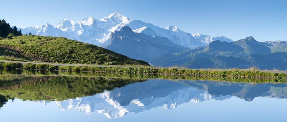
This route takes you to two mountain lakes in different valleys: Lac de Joux Plane in the Giffre valley, and Lac de Nyon in the Morzine valley. You'll also be able to admire Mont Blanc in the background!


